


What is AIS and how does it work
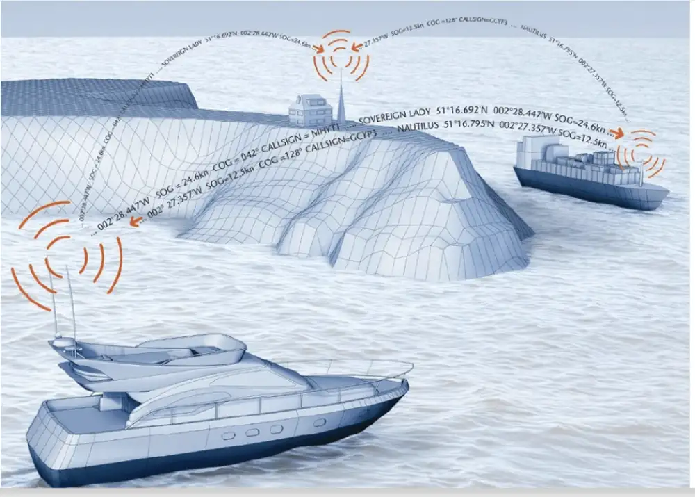
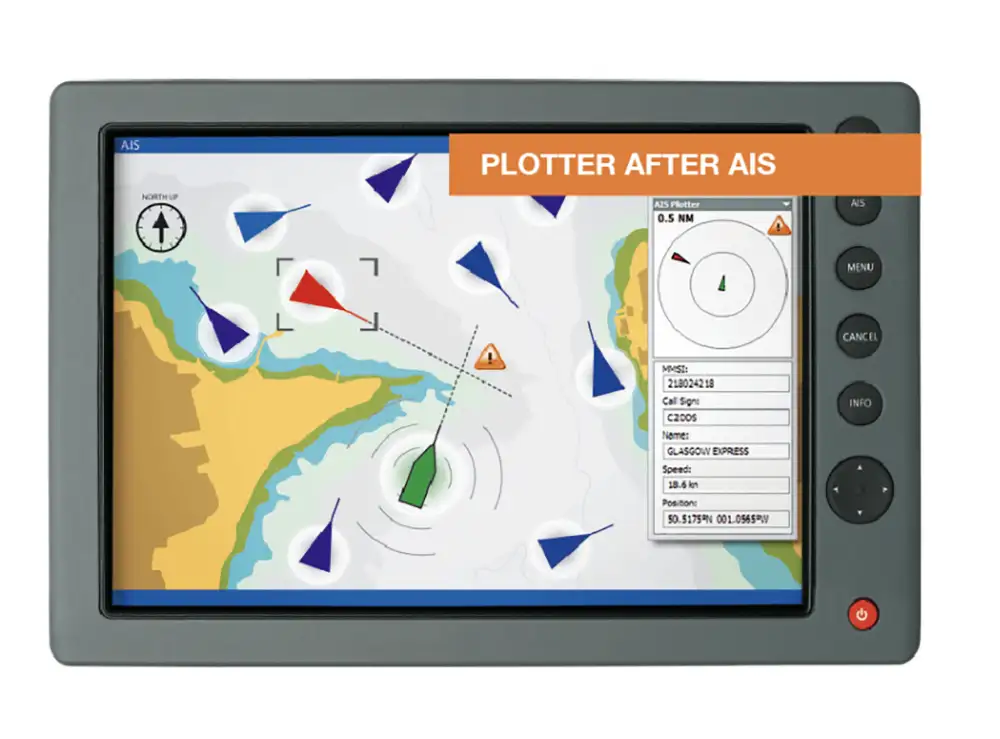
The Automatic Identification System (AIS) is a maritime navigation safety communication system that is used to avoid vessel collisions and provide important information, using standard marine data connections. It operates under the auspices of the International Maritime Organization (IMO). AIS technology relies on radio frequencies and, to some extent, manual data input. This makes it prone to human error or intentional AIS manipulation. An automatic identification system transmits a vessel’s key data via VHF (Very High Frequency) radio frequencies. Each AIS-equipped vessel broadcasts information such as its Maritime Mobile Service Identity (MMSI number), position, speed, course, and other navigational data at regular intervals. This information can be received by AIS transceivers on other ships and by AIS base stations located on shore, allowing for the tracking and monitoring of vessel movements. The data exchange includes both static information (e.g., vessel name, MMSI number, dimensions) and dynamic information (e.g., position, course over ground, speed over ground). The AIS system consists of a stand alone or shared antenna, a GPS aerial, and a control box.
The Uses of AIS in Sailing
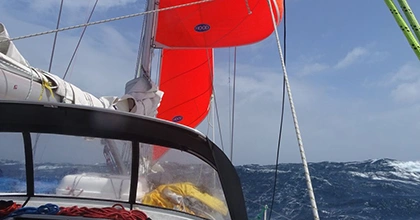
- Collision Avoidance: AIS transmissions allow other ais equipped vessels to see marine traffic in their vicinity in real-time, even if the other vessels are not visible to the naked eye (e.g., due to fog, distance, or being obscured by land).
- Traffic Management: VTS uses AIS to monitor and manage commercial vessels and other relevant traffic, especially in busy channels and ports, enhancing safety and efficiency.
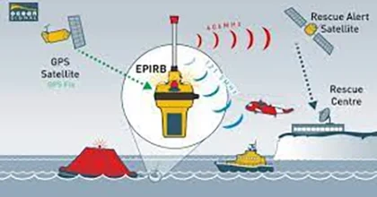
- Search and Rescue Operations: In emergency situations, AIS data can help rescue teams with ship location and reach the ship position quickly.
- Navigation Aid: AIS provides additional information to sailors, including the size, course, and speed of nearby vessels, helping in better decision-making while navigating.
- Fleet Tracking and Management: For commercial operators, AIS is used to track and manage maritime traffic, monitoring the location and status of each vessel in real-time. Coast stations can also use the AIS channels for shore to ship transmissions and to send information on tides, NTMs and located weather conditions. Coastal stations may also use the AIS to monitor the movement of hazardous cargoes and control commercial fishing operations in their waters.
Limitations of AIS in Sailing
- Dependence on Vessel Compliance: AIS effectiveness is partly dependent on all vessels in the vicinity being equipped with AIS transponders and ensuring they are correctly configured and operational.
- Data Overload: In highly congested areas, the volume of AIS signals can be overwhelming, making it difficult to identify relevant vessels among the many signals received.
- Signal Interference and Loss: Physical obstacles, such as large waves or dense cargo, and technical issues can sometimes interfere with the transmission and reception of AIS signals.
- False Sense of Security: Over-reliance on AIS data without cross-checking against radar, visual observations, and other navigational aids can lead to complacency and increased risk. Many fishing vessels don’t transmit AIS and nor do many small boats.
- Privacy Concerns: For some vessels, especially smaller or private ones, there may be concerns about broadcasting their location information publicly, potentially leading to privacy and security issues.
Despite these limitations, AIS as an automated tracking system has become a crucial tool for enhancing maritime safety and efficiency. Mariners are encouraged to use AIS in conjunction with other navigation aids and practices to ensure a comprehensive approach to safe navigation.
Maritime Law relating to AIS
SOLAS regulation V/19 requires AIS to be fitted aboard all ships of 300 gross tonnage and upwards engaged on international voyages, cargo ships of 500 gross tonnage and upwards not engaged on international voyages and all passenger ships irrespective of size. Ships fitted with AIS must maintain AIS in operation at all times.
AIS information may only be used to assist in collision avoidance decision-making. When using the AIS for anti-collision purposes, it does not replace, but supports, navigational systems such as radar target-tracking and use of a hand bearing compass. The use of AIS does not negate the responsibility of the master to comply at all times with the Collision Regulations, particularly rule 7 when determining whether risk of collisions exists.
The Range of AIS
The range of the Automatic Identification System (AIS) primarily depends on the type of AIS equipment, antenna placement, and the curvature of the Earth. AIS operates on VHF radio frequencies, which generally follow a “line of sight” propagation, meaning the signal travels straight from the transmitter to the receiver. Here are the key factors influencing AIS range:
1. AIS Class Types
- Class A: Typically used by commercial ships, Class A transceivers have a higher transmitting power (12.5 watts), which allows for a longer range, usually up to 20-30 nautical miles under normal conditions.
- Class B: Used by smaller vessels, including leisure crafts. Class B AIS transceivers have a lower transmitting power (2 watts), limiting their range to approximately 5-10 nautical miles.
2. Antenna Placement
The higher the antenna is placed, the further the “line of sight” extends over the horizon, increasing the AIS range. This principle applies to both receiving and transmitting antennas.
3. Geographical and Environmental Factors
The presence of obstacles like tall buildings, mountains, or heavy weather conditions can reduce AIS signal range. Conversely, some atmospheric conditions can occasionally extend the range significantly beyond typical limits.
4. AIS Base Stations and Repeaters
AIS base stations and repeaters installed along coastlines or on high ground can receive AIS signals from beyond the horizon and retransmit them, effectively extending the range. These stations can also forward AIS data to internet-based tracking services, making it possible to monitor vessel movements from anywhere in the world.
Typical Range Estimates
- At Sea Level: The line-of-sight range for an antenna at sea level is typically around 2-3 nautical miles.
- Elevated Antenna on a Vessel: For vessels with antenna placement high above the water, the range can easily extend to 20-30 nautical miles for Class A transceivers.
- AIS Base Stations: With their antennas placed at high elevations, base stations can detect AIS signals from vessels up to 40-60 nautical miles away, sometimes even further.
Extended Range via AIS Receivers and Satellites
- AIS Receivers: Strategic placement of AIS receivers can help capture data from vessels transmitting beyond direct line-of-sight distances.
- Satellite AIS (S-AIS): For global tracking, satellites equipped with AIS receivers can detect AIS signals from vessels anywhere in the world, overcoming the line-of-sight limitation altogether.
In summary, while the typical direct line-of-sight range of AIS varies between 5 to 30 nautical miles depending on the class of equipment and antenna height, the effective tracking range can be significantly extended through the use of base stations, repeaters, and satellites.
How to use AIS like a pro
Using the Automatic Identification System (AIS) like a professional requires more than just having the equipment onboard. It involves understanding its capabilities, limitations, and best practices for its use. Here are some advanced tips on how to use AIS effectively:
1. Make sure you understand your AIS Data
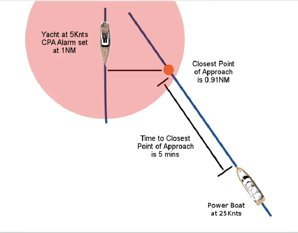
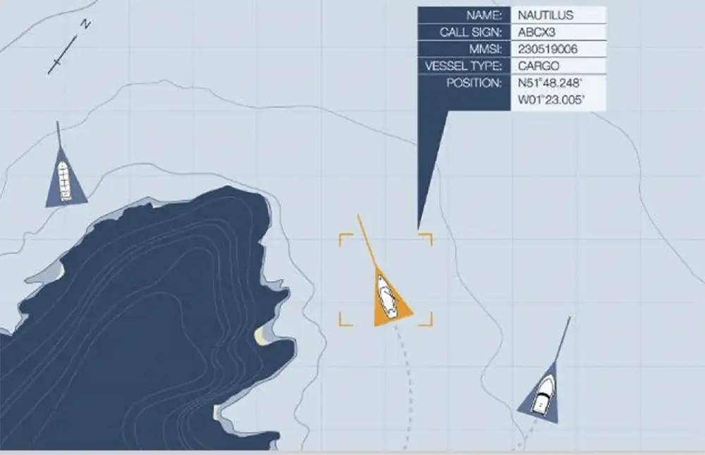
- Deciphering Information: Learn to quickly interpret the data provided by AIS, such as MMSI number (unique identifier for vessels), vessel name, course over ground (COG), speed over ground (SOG), CPA (Closest Point of Approach), and TCPA (Time to Closest Point of Approach).
- Dynamic and Static Data: Distinguish between dynamic data (e.g., position, course, speed), which updates frequently, and static data (e.g., vessel type, dimensions), which changes infrequently.
2. Integrate your AIS with Other Systems
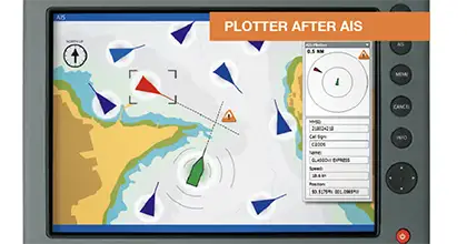
- Integrate AIS data with your electronic chart display and information system (ECDIS) or chartplotter for a comprehensive view of your surroundings.
- Use AIS in conjunction with radar, especially in poor visibility conditions, to validate targets and assess the situation accurately.
3. Set up AIS Filters and Alarms
- Customize Filters: In busy areas, use filters to display only vessels that pose a potential risk (e.g., those within a certain distance or on a collision course).
- Set Safety Alarms: Configure alarms for CPA and TCPA to receive early warnings of potential close encounters.
4. Learn How to Use Active Communication
- Use AIS data to identify vessels and initiate direct VHF communication for coordinating maneuvers, especially in congested waters or during close-quarters situations.
- Understand that not all vessels will be AIS-equipped, particularly smaller or older vessels, and maintain a lookout for non-AIS targets.
- Accept that to help maritime security, AIS data will be used on a real time basis by the authorities. Make sure your data is accurate
5. Ensure you Maintain Your AIS Equipment
- Regularly check your AIS transponder for correct operation, ensuring it’s transmitting and receiving data accurately.
- Update your vessel’s static information if there are any changes (e.g., vessel name, call sign) or when moving to a different vessel.
6. Be Aware of AIS Privacy and Security
- Be aware of the privacy settings on your AIS device, especially if you prefer to keep your vessel’s location private under certain circumstances (though note that disabling AIS can be illegal in certain areas or situations).
- Understand the implications of AIS data being publicly available and take precautions as necessary, especially if operating a vessel with security concerns.
Which Websites track AIS Data?
here are several websites where you can track vessels using Automatic Identification System (AIS) data. These platforms provide real-time and historical data on ship positions, courses, speeds, and other relevant information. Here are some popular AIS tracking websites:
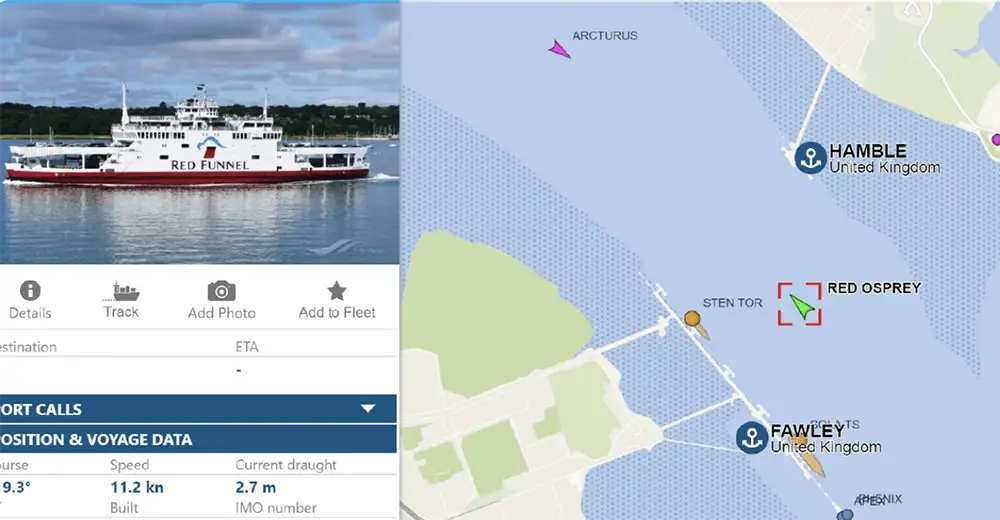
1. MarineTraffic
- Website: MarineTraffic
- Features: Offers real-time data on ships and yachts worldwide. Includes information on vessel positions, maritime news, and detailed vessel data. It allows users to search for ships and ports and view photos uploaded by the community.
2. VesselFinder
- Website: VesselFinder
- Features: Provides free real-time AIS vessel tracking and current position information on ships, along with vessel search, port search, and a weather forecast. It covers most major ports and shipping routes.
3. FleetMon
- Website: FleetMon
- Features: Allows users to track vessel movements in real-time, access detailed ship data, and receive maritime news. FleetMon is aimed at both maritime professionals and enthusiasts, offering tools for fleet tracking, port calls, and historical data analysis.
4. MyShipTracking
- Website: MyShipTracking
- Features: Offers vessel tracking services providing real-time positions of ships and yachts worldwide. The site features a user-friendly interface, detailed vessel information, and port arrivals and departures.
5. AIS Marine Traffic
- Website: AIS Marine Traffic
- Features: Another platform for tracking vessels using AIS, offering real-time position data, vessel details, and port information. This site might have similar functionalities as others listed but with a different user interface and coverage areas.
Key Considerations
- Coverage: While these sites strive to provide comprehensive global coverage, their effectiveness can vary by region and the density of AIS receivers in the area.
- Subscription Services: Most of these platforms offer basic tracking services for free but require a subscription for advanced features, such as detailed historical data, extended tracking ranges, and more frequent position updates.
- Data Accuracy: The accuracy and timeliness of data can vary. Real-time tracking might have a slight delay, and not all vessels may be visible due to AIS transponder settings, operational status, or geographical limitations.
These websites are valuable resources for maritime enthusiasts, professionals in the shipping industry, and anyone interested in vessel movements and maritime safety.
What are Some Recommended AIS units?
Selecting the right AIS unit for your yacht involves balancing factors such as functionality, compatibility with existing navigational systems, ease of use, and budget. Yachtsmen should consider devices that offer reliable performance, good range, and the specific features that meet their sailing needs. Here’s a look at some reputable AIS systems designed for yachts and leisure vessels, showcasing a range of options from simple receivers to more advanced transceivers.
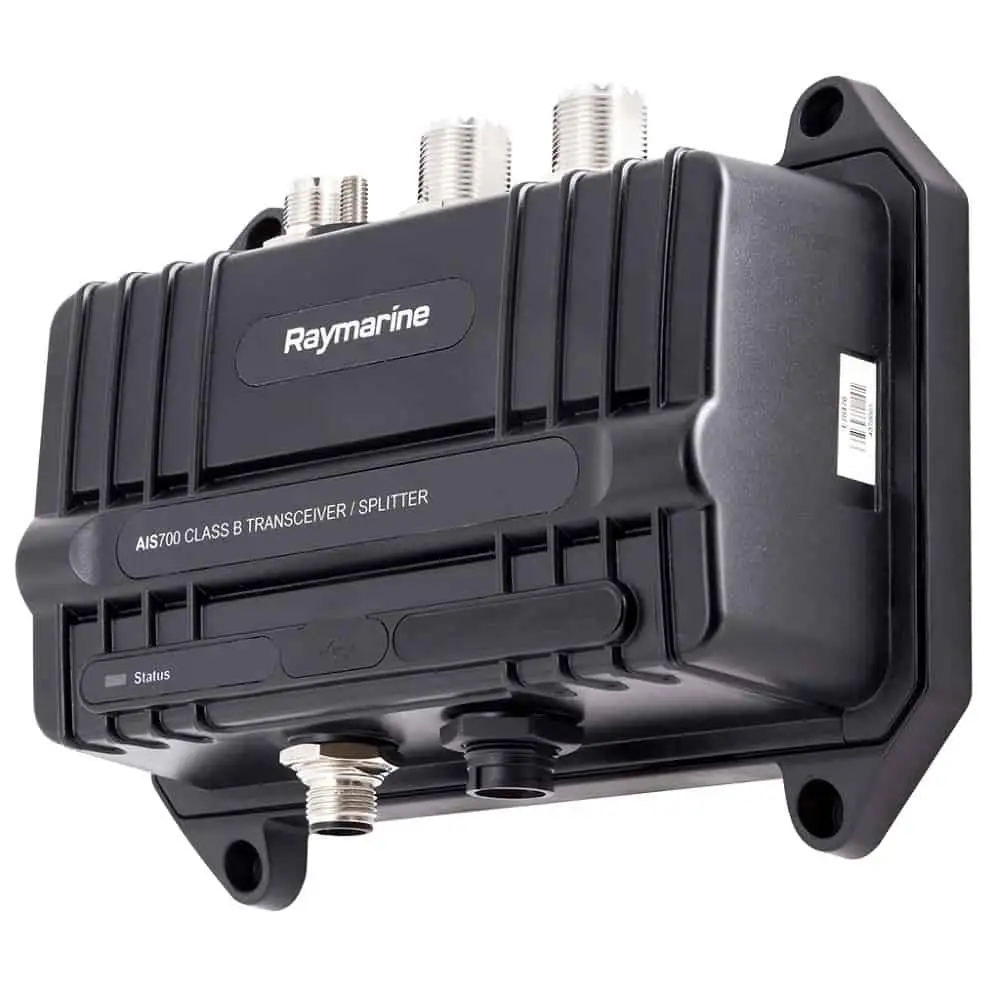
1. Raymarine AIS700 Class B Transceiver
- Features: The Raymarine AIS700 is a Class B SoT (SOTDMA) transceiver that allows for increased broadcast frequency when in busy areas, ensuring your vessel data is updated in near real-time. It integrates seamlessly with Raymarine’s line of chartplotters and multifunction displays, providing a comprehensive navigational solution.
- Ideal for: Yachtsmen looking for a high-performance AIS with excellent integration capabilities and enhanced situational awareness.
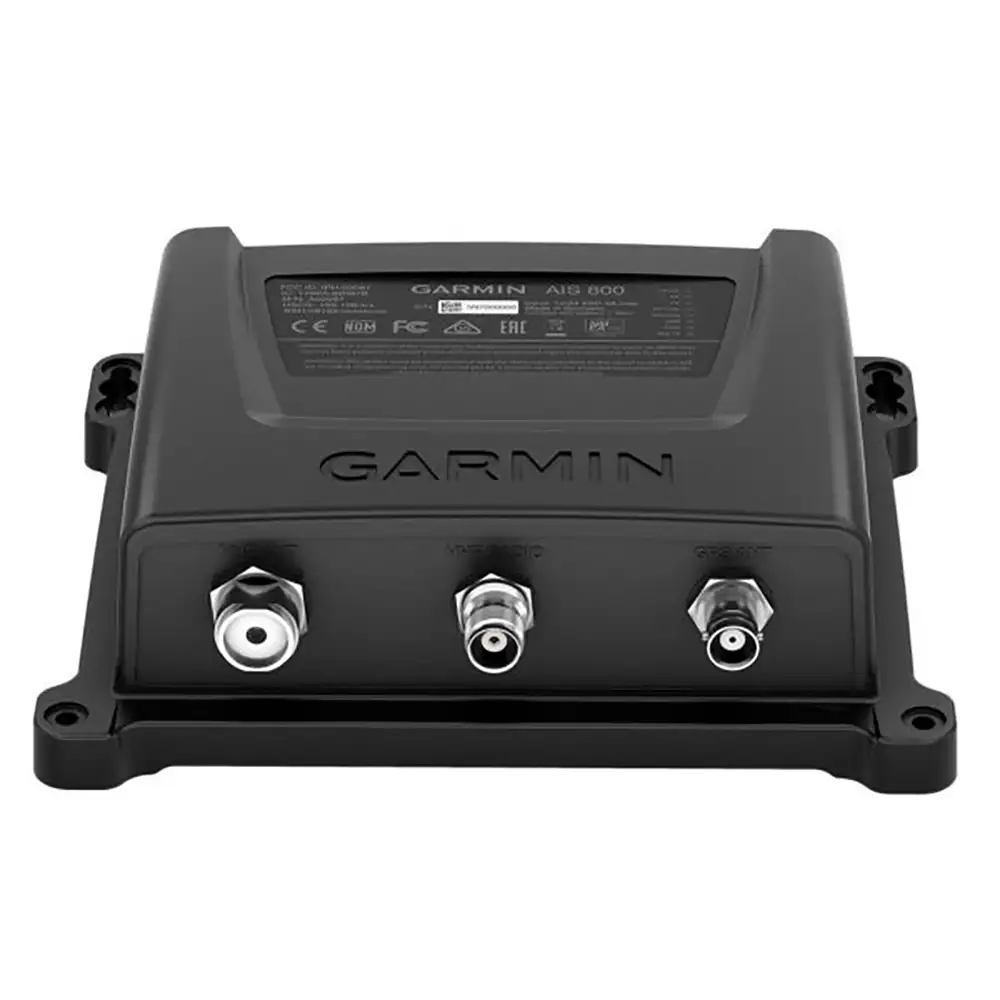
2. Garmin AIS 800 Class B Transceiver
- Features: Garmin’s AIS 800 boasts an internal GPS (no external GPS antenna required), easy integration with Garmin chartplotters and NMEA 2000 network, and 5 watts of transmit power, a bit more than the typical Class B AIS transceiver. Its compact size makes it suitable for a variety of yacht sizes.
- Ideal for: Sailors seeking a compact yet powerful AIS system that integrates well with Garmin products and other NMEA 2000 devices.
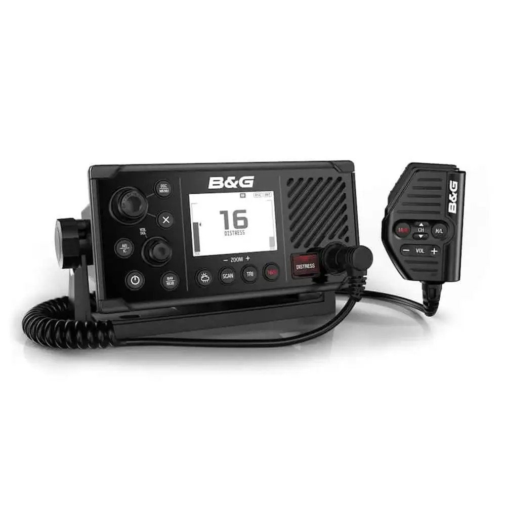
3. B&G V50 VHF Radio with AIS Receiver
- Features: This combination of a VHF radio and AIS receiver reduces the need for multiple devices, saving space without sacrificing functionality. The B&G V50 allows you to monitor AIS targets directly on the VHF radio’s display or via a connected chartplotter. Note that it’s an AIS receiver only, not a transceiver.
- Ideal for: Yachtsmen who prefer a multifunctional device that combines communication and AIS monitoring without the ability to transmit AIS signals.
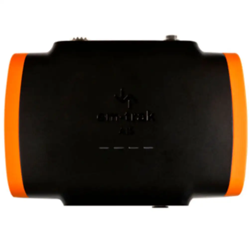
4. em-trak B100 AIS Class B Transceiver
- Features: The em-trak B100 is known for its robust build and reliable performance. It offers a range of features, including low power consumption, a secure and weatherproof design, and compatibility with all major chartplotters and PC navigation software.
- Ideal for: Sailors in need of a durable and efficient AIS transceiver that works well in a variety of conditions and setups.
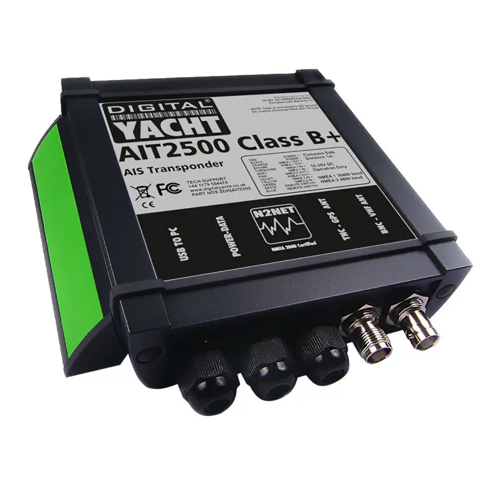
5. Digital Yacht AIT2500 Class B+ SOTDMA AIS Transceiver
- Features: The AIT2500 features SOTDMA technology, offering faster reporting rates and higher output power (5W) compared to standard Class B transceivers. It’s designed for seamless integration with existing navigation systems and provides excellent value for performance.
- Ideal for: Yachtsmen who require a more powerful AIS with quick update intervals, especially useful in busy maritime areas.
Considerations Before Purchase:
- Compatibility: Ensure the AIS system is compatible with your yacht’s existing electronic navigation systems.
- Installation: Consider the ease of installation, including antenna placement for optimal performance.
- Regulatory Compliance: Check that the AIS device complies with the regulations and standards of the waters you plan to navigate.
- Budget: Weigh the features and benefits of each system against its cost to find the best value for your needs.